Hike Through History on Greece’s Menalon Trail in 2026
26 September 2026
Some trails ask you to endure. A few ask you to notice. The Menalon Trail in the central Peloponnese belongs to the second category. It runs roughly 75 kilometers across the mountains of Arcadia, from the village of Stemnitsa to the coastal town of Lagadia, and it threads together stone bridges, Byzantine chapels, oak forests, and gorge paths that have carried shepherds, mule trains, and rebels for centuries. In 2026, it remains one of the most rewarding long-distance walks in southern Europe, and also one of the most misunderstood.
This is not a walk in the park. It is not the Camino. It is not a resort trail with luggage transfers at every turn. It is a specific, rugged, culturally dense route that rewards preparation and punishes assumptions. If you are considering it, the details matter more than the inspiration.
What the Menalon Trail Actually Is
The Menalon Trail is a certified long-distance path, marked and maintained, that crosses the Menalon mountain range in Arcadia. It is divided into eight sections, each usually walked in a day, connecting villages such as Stemnitsa, Dimitsana, Zygovisti, Elati, Vytina, Nymfasia, Magouliana, Valtesiniko, Lagadia, and several smaller settlements along the way. The total distance is often cited as about 75 kilometers, though the exact figure depends on which variants and village approaches you include.The trail was developed with support from local municipalities and hiking organizations, and it holds certification as a "Leading Quality Trail" under the European Ramblers' Association framework. That certification is not decorative. It means the route meets standards for waymarking, safety information, accommodation availability, and trail maintenance. In practice, it tells you that you can expect to find the path without a guide, that villages along the way have somewhere to sleep and eat, and that someone is responsible for keeping the route in usable condition.
What it does not mean is that the trail is easy, or that you can walk it in sandals with a daypack and no map.
Why Arcadia, and Why This Trail
Arcadia has a hold on the European imagination that predates any hiking trail. Poets used it as a symbol of pastoral simplicity. Painters placed shepherds and nymphs in its valleys. The reality is more interesting than the myth. This is a landscape of limestone peaks, deep gorges, and villages built from the same gray stone as the mountains around them. Water is everywhere, emerging from springs and disappearing into sinkholes, which is why the area developed early water-powered industries and why so many bridges and mills survive.The Menalon Trail works because it does not separate nature from culture. You are not walking through a preserved wilderness with a village at each end. You are walking through a working landscape where the history is underfoot. The path itself often follows old mule routes, the kind used to move goods between mountain villages before roads existed. The stone bridges you cross were engineered to survive flash floods. The monasteries and churches you pass were built in locations chosen for defensibility and water access, not for scenic value, though they happen to be scenic anyway.
This matters for how you walk. If you treat the trail as a physical challenge to be completed as fast as possible, you will miss most of what makes it worth doing. If you treat it as a museum with a path through it, you will underestimate the terrain. The right approach sits between those extremes.
The Eight Sections, Explained With Context
Most hikers break the trail into the standard eight stages. Each has its own character, and understanding that character helps you plan where to push and where to slow down.Stemnitsa to Dimitsana
This opening section is often described as one of the most beautiful on the trail, and it earns that reputation. You leave Stemnitsa, a stone village with a goldsmithing tradition, and follow the Lousios Gorge. The path passes the Prodromou Monastery, built into a cliff face, and the Old and New Philosophou Monasteries, which are among the most historically significant religious sites in the region. The gorge is lush, with plane trees and running water, and the walking is varied rather than monotonous.The trade-off here is popularity. Because this section is accessible and spectacular, it attracts day hikers and tour groups. If you want solitude, start early. If you want context, consider that these monasteries were centers of learning during periods when that was dangerous, and that the gorge itself has been a refuge for people fleeing lowland conflicts for centuries.
Dimitsana to Zygovisti
This stage climbs out of the gorge and into higher, more open terrain. Dimitsana is a substantial town with a library and a gunpowder mill museum, both worth an hour of your time. The walk to Zygovisti is shorter and less dramatic than the first day, which makes it a good transition. Zygovisti itself is small and quiet, a village that feels genuinely remote.A common mistake is to treat this day as filler. It is not. It is where you begin to understand the vertical logic of the trail, how villages sit on ridges and shoulders, and how the paths connect them along the easiest gradient rather than the shortest distance.
Zygovisti to Elati
This section crosses the higher slopes of the Menalon range. The vegetation shifts to fir and pine, and the views open up. Elati is a mountain village with a strong tradition of stonework and a reputation as a summer retreat for Greeks escaping the heat of the lowlands. The walking here is steady rather than steep, but the altitude means weather can change quickly.Elati to Vytina
Vytina is one of the larger villages on the route, known for its honey, its walnuts, and its role as a regional hub. The walk from Elati is relatively gentle, which makes it a good day to recover or to slow down and pay attention to the forest. This is also where you start to see the trail's role as a connector between communities rather than a wilderness route. You are never far from a road or a village, which is both a comfort and a reminder that this landscape has been inhabited for a very long time.Vytina to Nymfasia
This is a short stage, often combined with the next one. Nymfasia is tiny, and the walking is easy. If you are building a schedule, this is the day to either take a rest or to push ahead. There is no shame in either choice. The trail is not a test.Nymfasia to Magouliana
Magouliana sits high on the slopes of the Menalon range and is one of the most atmospheric villages on the route. The walk here is more demanding, with sustained climbs and exposed sections. The village itself has a history of resistance and migration, and its stone houses and narrow lanes reflect a community that has adapted to a difficult environment rather than tamed it.Magouliana to Valtesiniko
This stage continues across high ground, with long views and fewer settlements. Valtesiniko is small and traditional, and the approach to it is one of the quieter parts of the trail. If you are walking in summer, this is where you will appreciate the shade of the fir forests and the coolness of the altitude.Valtesiniko to Lagadia
The final section descends toward Lagadia, a village built on the edge of a gorge and known for its stone masons. The descent is steep in places, and the change in vegetation is dramatic. Lagadia feels like an ending, partly because it is, and partly because the architecture and the setting give it a sense of arrival that the smaller villages do not.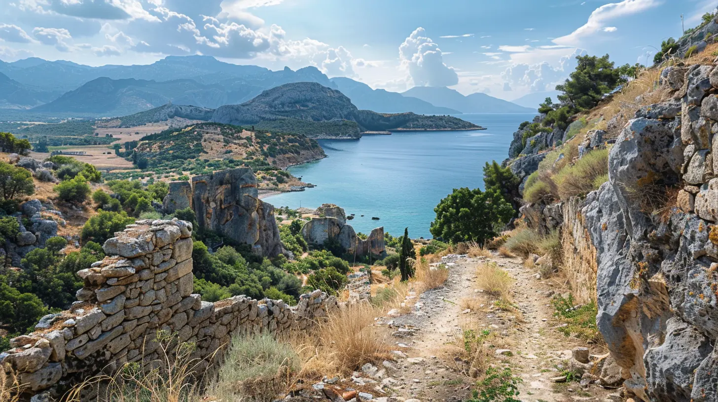
When to Walk, and Why Timing Changes Everything
The Menalon Trail is walkable from spring through autumn, but each season offers a different experience and a different set of problems.Spring, roughly April to early June, is the most popular window. Wildflowers are out, water sources are reliable, and temperatures are moderate. The downside is rain. The Peloponnese can be wet in spring, and the gorge sections can become slippery. Snow can linger on the highest sections into April, which may force detours or make certain stages unsafe.
Summer, July and August, is hot. Very hot. The trail is not coastal, so you do not get sea breezes. You get altitude and shade, which help, but you also get long days of exposed walking. If you walk in summer, start before sunrise and finish by early afternoon. Carry more water than you think you need. The villages have taps and fountains, but they are not evenly spaced.
Autumn, September to November, is arguably the best window. The heat has broken, the light is softer, and the trails are quieter. Rain returns in late October, and some accommodation may close at the end of the season. Check opening dates before you commit.
Winter is possible for experienced hikers with the right gear, but it is not recommended for most people. Snow, ice, and short daylight hours make the trail a serious undertaking rather than a holiday.
Accommodation, Food, and the Rhythm of the Villages
One of the trail's strengths is that it passes through villages with guesthouses, small hotels, and tavernas. You do not need to camp, and you do not need to carry days of food. This is a major advantage over more remote routes, and it changes the character of the walk. You end each day in a place with a bed, a shower, and a meal.That said, the infrastructure is not uniform. Some villages have multiple options. Others have one or two. In peak season, they fill up, especially on weekends when Greek families arrive from Athens. Book ahead. This is not a trail where you can reliably show up and find a room.
Food is a highlight. Arcadian cuisine is mountain food: hearty, seasonal, and based on local produce. You will find wild greens, legumes, lamb, local cheese, and honey. Vytina is known for its walnuts and honey. The villages along the route take pride in their food, and eating well is part of the experience.
A practical note: not every taverna stays open year-round, and not every one opens for lunch. If you are walking during shoulder season, call ahead or ask your accommodation to arrange something. This is not a failure of the trail. It is the reality of small mountain communities.
Navigation, Waymarking, and Common Mistakes
The trail is well marked. You will see painted waymarks, usually in the form of a specific symbol or color combination, on rocks, trees, and posts. In most places, you can follow the route without a map. In some places, especially where paths cross or where agricultural tracks intersect, you cannot.The most common mistake is overconfidence. People assume that a certified trail is a foolproof trail. It is not. Waymarks fade. Branches fall. Livestock move through gates and leave them open or closed in ways that confuse the route. If you are walking without a GPS track or a paper map, you are relying on luck as much as skill.
A second common mistake is underestimating the vertical gain. The trail is not long by long-distance standards, but it is steep in places. A 10-kilometer day with 600 meters of ascent is harder than a 20-kilometer day on flat ground. Plan by time and elevation, not just distance.
A third mistake is carrying too much. Because you sleep in villages, you do not need a tent, a stove, or days of food. You need water, layers, rain gear, sun protection, and a way to navigate. That is roughly it. Every extra kilogram is a tax you pay on every climb.
Gear That Actually Matters
Footwear is the single most important decision. You want shoes or boots with grip, because the trail includes wet rock, loose stone, and steep descents. Trail runners work for some people. Others prefer mid-cut boots for ankle support. The right answer depends on your knees, your load, and your experience. What does not work is smooth-soled sneakers or sandals.Trekking poles are genuinely useful here. The descents into and out of gorges are hard on the knees, and poles reduce the load. If you have never used them, practice before you go. They help most on steep, uneven ground, and they help least on flat, smooth ground.
Layers matter more than you expect. Mountain weather changes quickly. A warm afternoon can turn into a cold, windy evening. A light insulated layer and a waterproof shell are worth their weight.
Water is the other critical item. The trail has water sources, but they are not always where you need them. Carry at least two liters, and more in summer. A filter or purification tablets are a good backup if you plan to refill from springs.
The Cultural Dimension: What You Are Walking Through
The Menalon Trail is not just a path. It is a route through a region that has been shaped by specific historical forces. Arcadia was a center of the Greek War of Independence in the early 19th century. Dimitsana, in particular, was a base of operations and a center of gunpowder production. The monasteries in the Lousios Gorge were centers of learning and resistance. The stone bridges were built to move goods and people across difficult terrain.Walking the trail with some awareness of this history changes the experience. You start to see the bridges as engineering decisions, not just picturesque features. You understand why villages are where they are. You notice the way the path follows the contours of the land, because that is how mule drivers chose routes.
This is not about turning a hike into a history lesson. It is about paying attention. The trail rewards attention.
Practical Planning: How to Structure Your Trip
There is no single correct way to walk the Menalon Trail. Some people walk it in eight days, one section per day. Some walk it in five or six by combining shorter stages. Some walk it in sections over multiple trips. All of these are valid.The key variable is how much time you want in the villages. If you are focused on the walking, you can move faster. If you want to spend afternoons in Dimitsana or Vytina, you need more days. There is no wrong answer, but there is a trade-off. Faster means more miles and less context. Slower means more context and more logistics.
Logistics are simpler than they look. Buses connect some villages, and taxis are available, though not always cheap. Many hikers arrange luggage transfers between accommodations, which lets them walk with a daypack. This is a real option and worth considering if you want to reduce strain. It costs money, and it requires planning, but it changes the experience for the better for many people.
What Makes This Trail Different From Other Long-Distance Routes
The Menalon Trail is not the Camino de Santiago. It does not have the same infrastructure, the same social scene, or the same sense of a shared pilgrimage. It is not the Tour du Mont Blanc, with its high alpine drama and its circuit format. It is not the West Highland Way, with its specific Scottish character.What it is, is a compact, culturally rich, logistically manageable route through a landscape that has been inhabited and shaped for millennia. It is short enough to fit into a week. It is varied enough to stay interesting. It is challenging enough to feel like an achievement. And it is quiet enough, outside peak weekends, to feel like yours.
That combination is rare. It is why the trail has gained a following among hikers who want something more than a workout and less than a expedition.
Final Considerations Before You Go
Do not treat the Menalon Trail as a bucket-list item to be checked off. Treat it as a week of walking through a place that has its own logic and its own pace. Prepare your body. Pack light. Learn a few words of Greek. Book your rooms. Carry a map. Start early. Slow down.If you do those things, the trail will give you something that is hard to find in modern travel: a sense of moving through a landscape at the speed it was meant to be experienced. Stone by stone. Bridge by bridge. Village by village.
all images in this post were generated using AI tools
Category:
Iconic RoutesAuthor:

Reed McFadden